Map and Directions
- The most relevant paper map is the O.S. 1:25,000, Explorer Map OL2, Yorkshire Dales, Southern & Western areas, Grid. Ref. 633813.
- Most maps on the internet, and sat–navs, are post–code based. In rural locations, post–codes can cover large areas, and you may end up being directed to a neighbouring farm. If you follow the standard Google directions to Whelprigg House you will end up going round the houses just to find yourself in the middle of nowhere. However . . . .
- The Google map below has been corrected to get over this problem, as has the link to Street Map. Both have arrows pointing to the bottom of the main drive.
- The written directions given further down this page also work.
See also OS–based, StreetMap.
From the M6, Junction36
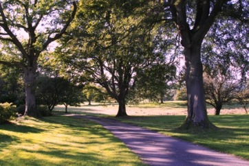
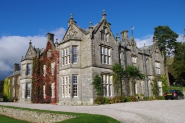
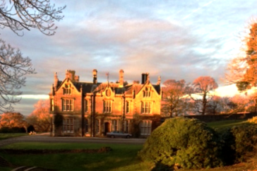
Take the A65, South–east towards Skipton. After about six miles, near Kirkby Lonsdale, take the A683, North towards Sedbergh. Half a mile beyond the village of Casterton, fork to the right onto a narrow lane sign–posted for Barbon. After half a mile you will see, to your right, a stone archway (part of an old railway embankment). Go through this archway and up the drive to Whelprigg House.
From Yorkshire on the A65
As you approach Kirkby Lonsdale from the East on the A65, take the A683, to the right and sign–posted for Sedbergh. Half a mile beyond the village of Casterton, fork to the right onto a narrow lane sign–posted for Barbon. After half a mile you will see, to your right, a stone archway (part of an old railway embankment). Go through this archway and up the drive to Whelprigg House.
From Sedbergh on the A683
From Sedbergh, take the A683 South towards Kirkby Lonsdale. After about seven miles follow the sign for the village of Barbon, to the left. At the war memorial in Barbon, turn right, to the South, and follow the road for one mile. On your left you will see a stone archway (part of an old railway embankment). Go through this archway and up the drive to Whelprigg House.